geology
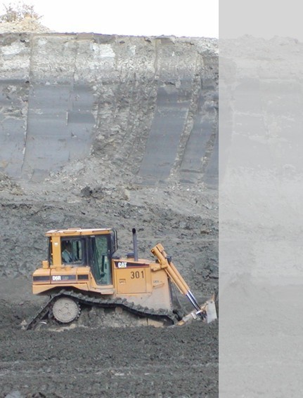
Superficially, the "Eichenallee" clay deposit consists of Pleistocene sediments. These are primarily
glacial loam with individual pieces of rock rubble and till as weathered remnants of ice-age glacial
ground moraine. The Quaternary deposits within the area under application reach a mean thickness of
approx. 2.5 m.
The cover layer is followed below by the Tertiary deposits of the Lintfort and Ratingen layers which
form the clay deposit for extraction. With its excavation depth of about 15 metres over an area of 33.5
hectares, the "Eichenallee" clay pit has a huge potential of the high-grade material clay
which can be used for the most varied applications.

hydrogeologie
The earth formation in the projected area has two levels of groundwater storeys, separated from
each other by the clay deposit. The upper storey is made up of the Quaternary deposits. Because of
the very poor water permeability of the glacial loam, the water regime is dependent on precipitation
and is low. Because of their high density, the Tertiary layers lower down - the clayey to silt-clayey
Lintfort layers and also the Ratingen clay - are considered to be aquicludes. In the area of the
planning project they have a thickness of at least some 30 metres. On account of these geological
conditions, the "Eichenallee" clay extraction has a "natural seal" which
provides a particularly favourable starting point when the pit is subsequently refilled.
The Walsum layers are located in the floor of the deposit. In the area around the Gartroper Busch
they form, together with the Cretaceous Recklinghausen layers below, the second groundwater storey
with a confined water table. In the area of the project, the groundwater is not utilised as a source
of potable water so that this region is not designated as an area under drinking water protection.
In the area under projected planning there are no so-called Haltern sands which conceal considerable
groundwater resources and are used as numerous groundwater abstractions. They only begin further north.


